DNA07 P&S
P- and S-velocity models for the western US
DOWNLOAD THE MODEL
If used please cite:
Xue, M. and R.M. Allen (2010) Mantle Structure Beneath the Western US and its Implications for Convection Processes, J. Geophys. Res. 115, B07303, doi:10.1029/2008JB006079 View reprint
Model highlights:
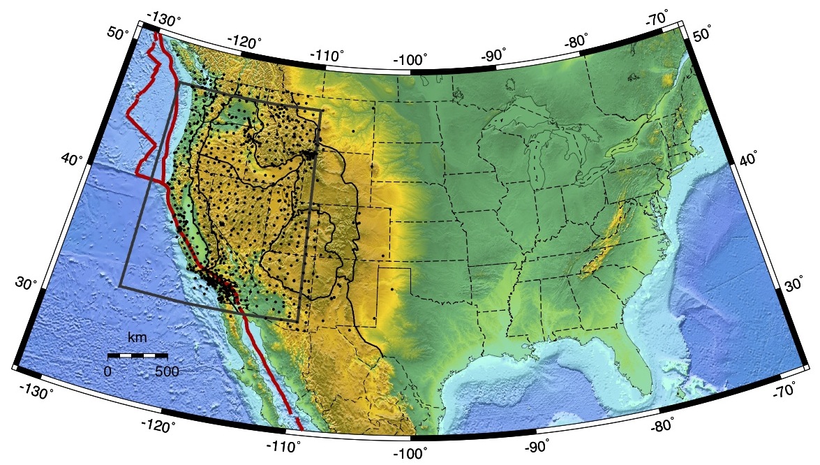
In these first models of the DNA series, the shallow depth extent of the Juan de Fuca subduction system is imaged with a low velocity "slab window" to the south of the Mendocino Triple Junction. Beneath Yellowstone, a low velocity conduit dips to the northeast. The model uses Earthscope data up to October 2007 and the coverage therefore extends from the Pacific coast to the mid-Rocky Mountains (~110 deg W).
Model specifications:
- Parameters: DNA07-P and DNA07-S are P- and S-velocity models
- Coverage: Stations available cover the region from the Pacific coast to the Rocky Mountains (110 deg W), from the Mexican boarder (31 deg N) to the Canadian boarder (49 deg N).
- Data source: More than 600 stations were used from the USArray transportable array, regional seismic networks, and temporary seismic deployments.
- Data type: Relative traveltimes of teleseismic body waves (P, S and SKS) are used to constrain the model.
- Inversion: The matrix is constructed using ray-theory and inverted using LSQR with appropriate damping and smoothing.
- Resolution: The model can resolve mantle structure to a depth of ~750km and with a lateral and vertical resolution of ~200km.
Publication
Xue, M. and R.M. Allen (2010) Mantle Structure Beneath the Western US and its Implications for Convection Processes, J. Geophys. Res. 115, B07303, doi:10.1029/2008JB006079View reprint