Earthquake early warning milestones
Earthquake alerts are now available across much of the globe thanks to partnerships among scientists, policy makers and industry. UC Berkeley's role in the scientific development of earthquake early warning is recorded in our academic publications. Here, we detail some of the other milestones towards our goal of global earthquake alerts.
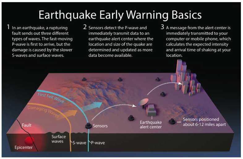
For information on how the earthquake early warning works, visit our Berkeley Seismo Lab Earthquake Early Warning pages.
2025
Google reports on global earthquake alerting progress
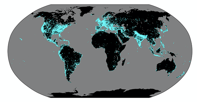
In “Global earthquake detection and warning using Android phones”, published in Science, we reported on the performance of the supplementary Android Earthquake Alerts system based on the first three years of operation. At the time of publication, the system was delivering alerts in 98 countries. As shown in the plot, the Android system is largely responsible for the rapid growth in the number of people with access to earthquake early warning. The number has expanded from ~250 million people receiving alerts in 2020, to over 2.5 billion today. The Google Research blog summarizes the work.

Upper map: Light green areas show the countries where the Android Earthquake Alerts System is currently detecting and delivering alerts. The areas alerted in individual earthquakes are shown in red where there was strong shaking (Modified Mercalli Intensity (MMI) 5+) and yellow for lighter shaking (MMI 3-4). The gray circles indicate other Android detections in regions where alerts were not issued. Android also delivers alerts generated by ShakeAlert in California, Oregon and Washington (dark green). Lower bar chart: The global reach of EEW has expanded dramatically with the introduction of the Android system.
The paper reports on over 11,000 earthquakes detected by Android phones around the globe with magnitudes ranging from M1.9 to M7.8. Alerts were delivered when the estimated magnitude is M4.5 and greater, a total of 1279 events. The system issues alerts for approximately 60 earthquakes per month to an average of 18 million phones. As with other early warning systems around the globe, the system continues to be improved as more events are detected and the algorithms tuned. A comparison of the magnitude accuracy for the Android system with the US ShakeAlert and the Japanese JMA systems shows they are similar, while the Android system issues alerts for an order of magnitude more earthquakes.

A snapshot of what over 1.5 million users reported about their experience with the earthquake alerts.
Another unique feature of the Android system is the scale of the user feedback collected. Over 1.5 million users completed a survey revealing important details about system performance and users sentiment.
2024
MyShake and ShakeAlert: the first 5 years of alerting

As of October 2024, MyShake and ShakeAlert have been delivering alerts to the public for 5 years. How did we do? ShakeAlert is the detection system. It detected 144 earthquakes with an estimated magnitude of 4.5 or greater. Of those 141 were true alerts. Only 3 were false events. The three ‘false’ events were all real earthquakes but they were poorly located. If you look at the 3-year performance report below, you will see the same 3 events so no additional false events in the last few years! There were a total of 9 missed events meaning earthquakes occurred with magnitudes greater than 4.5 but they were not detected. As you can see from the map, they were all at the edge of the operational area.

MyShake continues to deliver alerts to both iPhone and Android users when they download the free MyShake app. Just prior to the 5th anniversary of public alerts, the M5.2 Lamont earthquake occurred near Bakersfield. MyShake delivered alerts to over half a million phones in the affected area. The warning was delivered to 97% of phones prior to the S-wave arriving and warning times ranged from a few seconds to almost a minute.

2022
Three years of public alerting in California

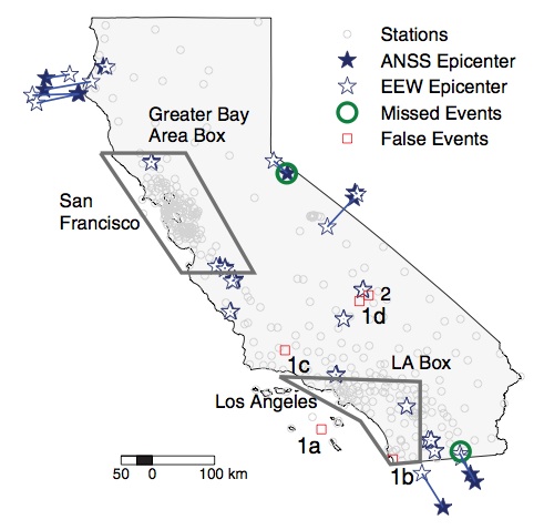
ShakeAlert has been delivering public alerts for three years, since October 2019. As of 12/8/22, it issued 78 alerts for earthquakes with an estimated magnitude of 4.5 or greater. Of those, 75 were "true" alerts. The remaining 3 were classified as false alerts. In all three cases they were real earthquakes, but the EPIC algorithm that generates the alerts located them poorly. This is because the earthquakes were outside the seismic network (either offshore or on the California-Nevada border). A future improvement to EPIC (developed and maintained at UC Berkeley) improves the location of these out-of-network events. The MyShake app delivered alerts to those in the felt shaking region for all these events. There were 8 missed events, earthquakes with magnitude greater than 4.5 for which no alert was issued. All 8 were around the edge of the seismic network.
Global EEW rollout continues with Android Earthquake Alerts and TRUAA in Israel
The global rollout of the Android Earthquake Alerts system continued as shows on the map above. At the conclusion of the year the Android system was delivering alerts in 93 countries. In January of 2022, the TRUAA earthquake early warning system also started delivering warnings in Israel. TRUAA is operated by the Geological Survey of Israel. It uses the EPIC algorithm developed at UC Berkeley to generate the alerts using seismic data from the Israeli National Seismic Network.

MyShake alert for magnitude 6.4 earthquake sent to over 270,000 phones
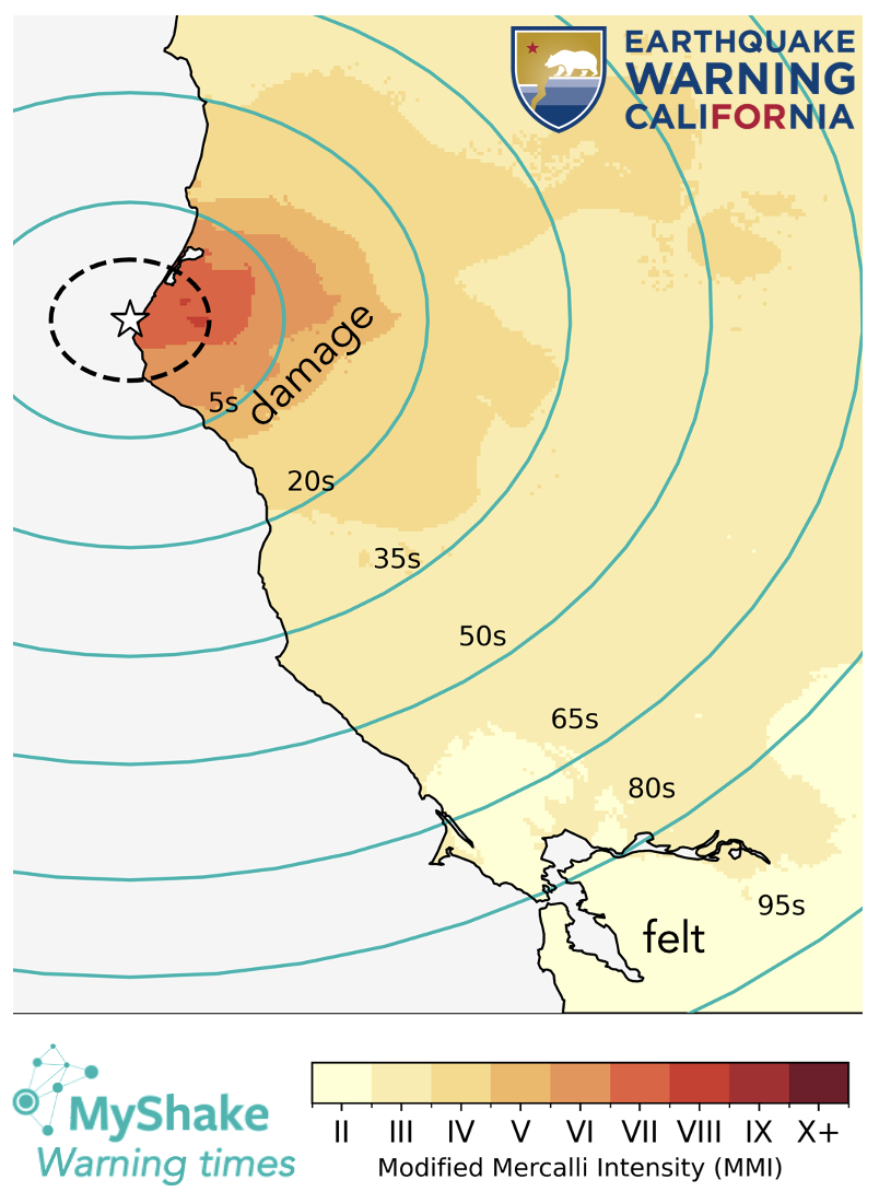
On December 20, 2022 a magnitude 6.4 earthquake shook northern California with an epicenter close to Ferndale. The free MyShake app delivered alerts to over 270,000 phones across the shaking region. The MyShakeMap above shows the warning times and shaking intensity. The green circles show the warning time MyShake users received before the S-wave shaking. They are based on real measurements of when phones received alert messages. The yellow-orange-red color shows the shaking intensity. Intensity II and greater is felt, intensity V and greater causes damage. People who experienced damage received up to ~10 sec warning, those who felt the earthquake received up to 95 sec warning. People within the dashed black circle received alert messages after shaking began (late warnings).
2021
Google now rolling out the Android Earthquake Alerts System globally
In 2020, Google launched the world's largest earthquake detection system based on technology built into Android devices. In 2021, the system started to deliver earthquake early warning alerts generated by Android's global detection system. Initially, in April, alert delivery started in New Zealand and Greece. Then in June, alert delivery expanded to Turkey, the Philippines, Kazakhstan, Kyrgyz Republic, Tajikistan, Turkmenistan and Uzbekistan. Google is prioritizing launching in countries with higher earthquake risks, and to launch in more and more countries over the coming year.

Users receive "Take Action" alerts that take over the screen if you are in the strong shaking zone (MMI intensity 5 and higher). Users in the weak shaking zone (MMI intensity 3 and 4) receive "Be Aware" notifications that are more typical of other notifications that you might receive on your phone. Alerts are only sent for earthquakes with magnitude 4.5 or greater.
The Android Earthquake Alerts system continues to deliver alerts generated by ShakeAlert in the US, in California, Oregon and Washington.

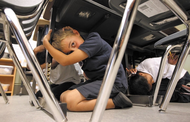
With an alert on your phone, you can use a few seconds warning to drop, cover and hold on, before the shaking starts. (Animation courtesy of Google)
ShakeAlert coverage extended to Oregon and Washington
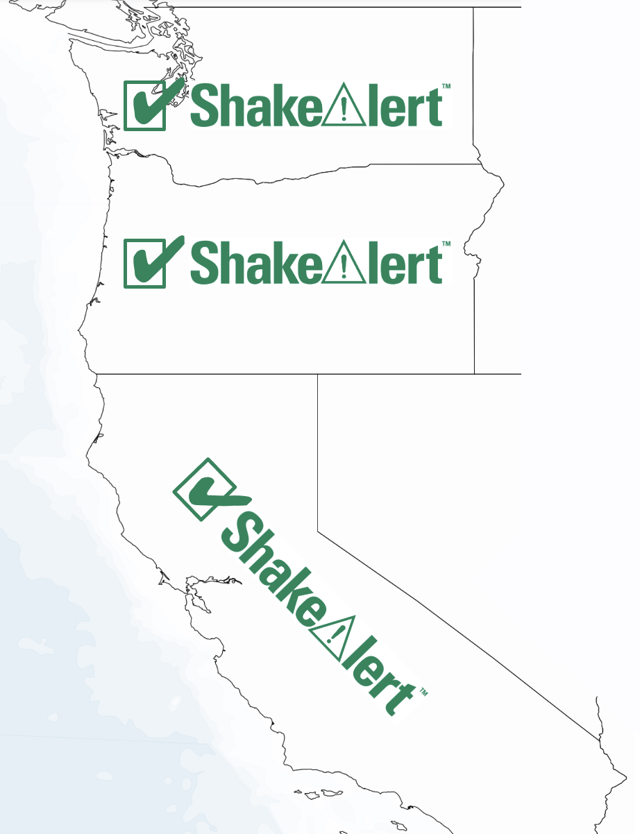
The ShakeAlert collaboration between Berkeley and Caltech was first funded by the USGS in 2006. In 2011, the collaboration extended beyond California to include the Universities of Washington and Oregon. This collaboration has been working towards public earthquake early warning across the three states for a decade. On May 4, 2021 this milestone was accomplished with public alerts now available across all three states. Congratulations to the ShakeAlert team at many institutions.
2020
Google launches the Android Earthquake Alerts System
On August 11, 2020 Google announced that it was bringing global earthquake detection, earthquake information and alerting into the Android ecosystem. Adapting the MyShake concept, Android phones around the globe are now mini-seismometers able to detect earthquake shaking. Initially, the earthquake detections will feed information to people through Google Search, but the goal is to use the Android network to deliver alerts around the globe.
As part of the same announcement, earthquake alerts generated by the ShakeAlert early warning system will immediately be available on all Android phones in California. This provides another channel for people to receive these critical alerts. They are now available natively within Android, by downloading the MyShake app (iOS and Android), or through WEA.
.
Publications and IP
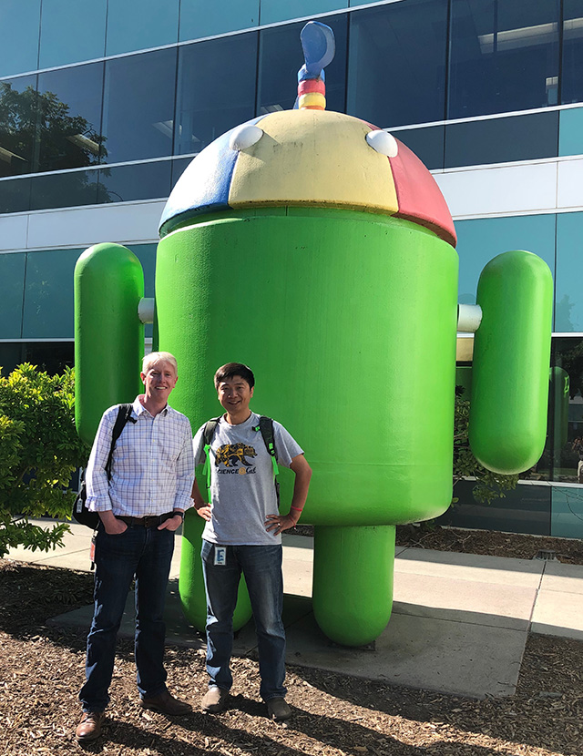
Richard Allen and Qingkai Kong at Google Android during their collaboration
2019
MyShake 2.0 launches and delivers public earthquake alerts across California
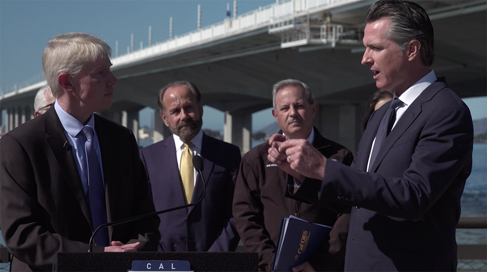
On October 17, 2019, California Governor Gavin Newsom announced that earthquake early warnings would now be available to the public across California using UC Berkeley’s MyShake app. Sponsored by the Governor's Office of Emergency Services, a new version of MyShake was released with the capacity to deliver ShakeAlert warnings to the public. Overnight, MyShake was downloaded by hundreds of thousands of people across California on both Android and iOS platforms.
Publications and IP

Google licences the MyShake IP from UC Berkeley

Earthquake Early Warning: Advances, Scientific Challenges, and Societal Needs by Allen and Melgar in Annu. Rev. Earth Planet. Sci.
2018
ShakeAlert is "open for business"
In a press conference at the Downtown Berkeley BART station on October 8, 2018, the ShakeAlert partners announced that ShakeAlert was available to deliver earthquake alerts across California, Oregon and Washington. The BART train system in the Bay Area was one of the first test users of the warning system and demonstrated how the alerts could slow and stop the trains. But, there was no mechanism to deliver alerts to the public, yet.

Following the press conference, VIPs and the media took a ride on a new BART train to demonstrate how the system works. From left to right: Oakland Mayor Libby Schaaf, BART Board of Directors President Robert Raburn, Congressman Adam Schiff, State Senator Jerry Hill, Berkeley Seismology Lab Director Richard Allen and CalOES's Ryan Arbor.
Publications
Revised technical implementation plan for the ShakeAlert system — An earthquake early warning system for the West Coast of the United States by Given et al, a USGS Open File Report.
2016
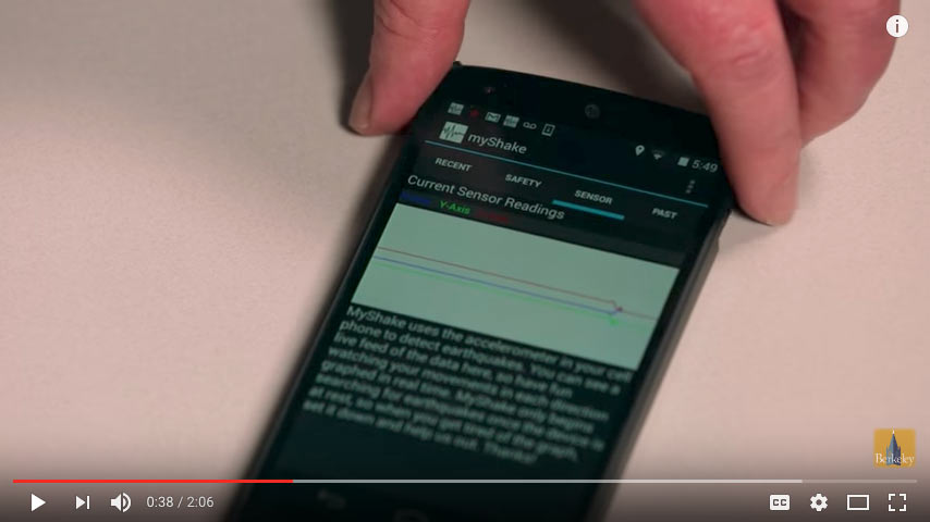
MyShake citizen science smartphone app launches
The Berkeley Seismology Lab annouced the launch of its MyShake app at the annual meeting of the American Association for the Advancement of Science. Funded by the Moore Foundation, the freely available smartphone app turnes personal smartphones into a network of earthquake sensors. Global press coverage led to some 100,000 downloads within a few weeks, and MyShake became the largest seismic network with sensors distributed around the world.
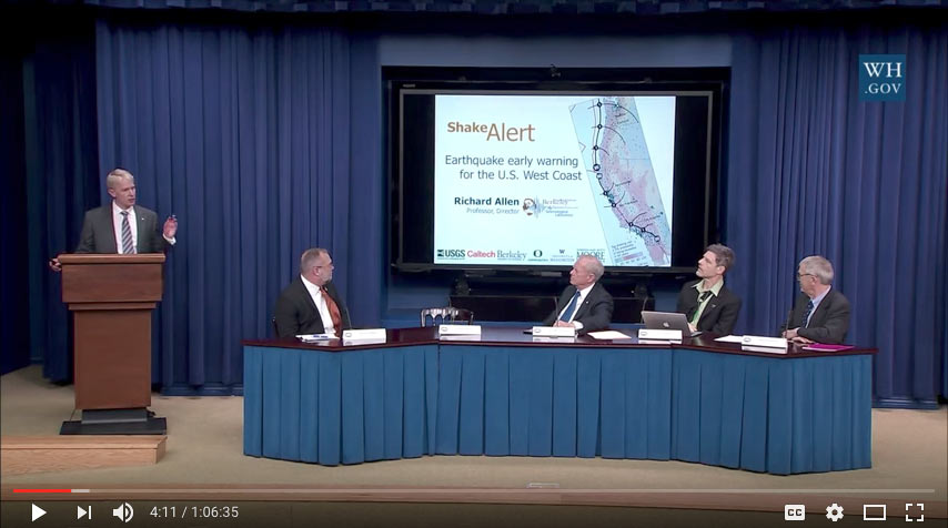
White House summit on Earthquake Early Warning
In February 2016, the White House hosted a summit on earthquake resilience to promote the concept of earthquake early warning. UC Berkeley and other scientists, legislators, and users of the prototype system all spoke to the value ShakeAlert could provide in future earthquakes.
Publications
MyShake: A smartphone seismic network for earthquake early warning and beyond by Kong, Allen, Schreier, and Kwon published in Science Advances.
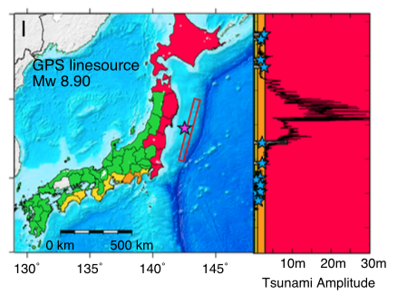
The T-larmS algorithm extends earthquake early warning to provide rapid local tsunami warning. The approach is described in Local tsunami warnings: Perspectives from recent large events by Melgar et al published in Geophys. Res. Lett..
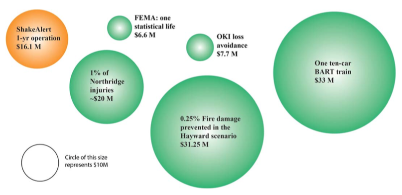
Benefits and Costs of Earthquake Early Warning by Strauss and Allen, published in Seismo. Res. Lett..
2014
Federal funding to start construction of ShakeAlert
In December 2014, the US Congress provided the first funding specifically to build ShakeAlert with a $5M appropriation of federal funding via USGS’s budget. Congressional champions included US Senator Dianne Feinstein (D-CA), Congressman Adam Schiff (D-CA) Congressman Ken Calvert (R-CA) and Congresswoman Barbara Lee (D-CA.)
Berkeley hosts International Meeting on Earthquake Early Warning
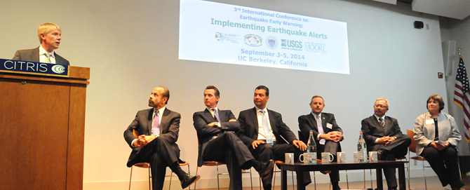
The opening session (pictured above) included (from left to right) Prof. Richard Allen, State Sen. Jerry Hill, then Lt. Gov. Gavin Newsom, then State Sen. Alex Padilla, Office of Emergency Services Director Mark Ghilarducci, San Francisco Mayor Ed Lee and USGS Acting Director Suzette Kimball.
Two weeks after the M6.0 Napa earthquake, the Berkeley Seismology Lab hosted an international meeting on earthquake early warning. Attended by scientists, industry partners and politicians, the meeting led to federal funding for ShakeAlert. During the summit, then Lieutenant Governor Gavin Newsom announced, "Disaster Preparedness is now my top priority. Whether through public education and outreach, advance warning systems, or protecting our infrastructure, we must leverage technology, innovation and the public will to revive our woefully inadequate disaster preparedness structure."
ShakeAlert provides warning in M6.0 Napa earthquake

Earthquake early warning featured on MSNBC's Rachel Maddow - Moment of Geek: Quake warning provides extra life-saving seconds (screenshot)
The M6 Napa earthquake at 3:20 am on August 24, 2014, rattled the entire San Francisco Bay Area. Damage was mostly confined to the Napa area, but the entire region was reminded of the earthquake threat. ShakeAlert issued a warning to test users in the Bay Area, including BART, San Francisco Emergency Management, UC Police, and Google. The alert came from Berkeley’s ElarmS algorithm.
Publications
Technical Implementation Plan for the ShakeAlert Production System—An Earthquake Early Warning System for the West Coast of the United States by Given et al published by the US Geological Survey
The 2014 Mw 6.0 Napa earthquake, California: Observations from real-time GPS-enhanced earthquake early warning by Grapenthin, Johanson and Allen published in Geophys. Res. Lett.
Designing a Network‐Based Earthquake Early Warning Algorithm for California: ElarmS‐2 by Kuyuk and Allen published in Bull. Seismo. Soc. Am.
CISN ShakeAlert – An Earthquake Early Warning Demonstration System for California by Boese et al published in Early Warning for Geological Disasters - Scientific Methods and Current Practice
2013
California passes earthquake early warning legislation
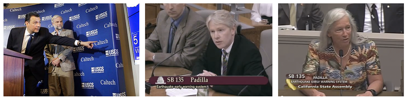
From left to right: Then State Senator Alex Padilla and the USGS EEW coordinator, Doug Given, as a press briefing about the legislation. Richard Allen and Peggy Hellweg of the Berkeley Seismology Lab giving testimony at the various Senate committee hearings.
Sponsored by then State Senator Alex Padilla, California passed legislation to develop a public earthquake early warning system. The bill was later carried by State Senator Jerry Hill, when Padilla became Secretary of State.
Publications
Seconds Count: The United States should install an earthquake early-warning system now — and before the next big one hits by Allen was published in Nature
2011
Earthquake Early Warning Summit following M9 Tohoku-Oki earthquake
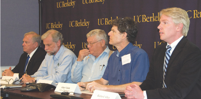
Summit participants at the press briefing that followed. From left to right: John McPartland (BART), Doug Given (USGS), Tom Heaton (Caltech), John Vidale (then University of Washington), and Richard Allen (Berkeley).
In the devastating M9 earthquake in Japan an alert was issued across Japan before the shaking. Only weeks after this event, the Berkeley Seismology Lab hosted a summit with scientists, legislators, foundations and the private sector. At the summit, a plan was developed to implement a prototype early warning system in the short-term, with a long-term goal of delivering open public alerts in California, Oregon and Washington. The Universities of Washington and Oregon joined UC Berkeley and Caltech in the cooperative agreement with the US Geological Survey, and the Gordon and Betty Moore Foundation made a $6.5M investment in the project to complete the development of the system. This summit was also the beginning of the development of legislation in California to provide early warning.
Publications
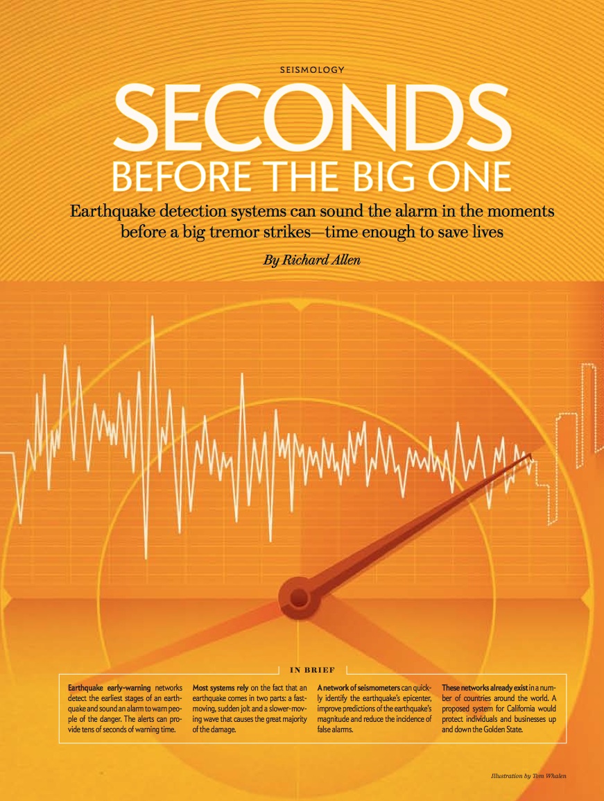
Seconds before the big one by Allen and published in Scientific American detailed how a U.S. warning system would work.
2007
First real-time generation of an earthquake alert in California

The Berkeley Seismology Lab's prototype ElarmS algorithm was up and running when the M5.4 Alum Rock earthquake rattled the San Francisco Bay Area on Oct. 30, 2007. ElarmS detected the earthquake in real time and generated an alert.
In 2006, the US Geological Survey (USGS) began funding the ShakeAlert cooperative research agreement between UC Berkeley, Caltech and the USGS. This collaborative project was the beginning of the partnership that developed ShakeAlert and continues to operate the system today. The Alum Rock earthquake was the first proof-of-concept event for the ShakeAlert partnership, demonstrating the technical feasibility of rapid earthquake detection and alerting. More details about the quake detection are here.
Publications
The ElarmS earthquake early warning methodology and its application across California by Allen was published in the special volume Earthquake Early Warning Systems. This publication detailed the methodology now at the heart of ShakeAlert.
2003
The potential for earthquake early warning in California

Published in Science, this manuscript authored by Richard Allen and Hiroo Kanamori detailed the scientific foundations and the methodolgy for the development of an early warning system in Southern California. It catalyzed research and development efforts in the United States, Europe and across Asia. The ElarmS alerting algorithm described in this manuscript has since been operationalized in Chile, South Korea, Italy and Israel, and now provides ShakeAlerts across California, Oregon and Washington.
Publications
The potential for earthquake early warning in southern California by Allen and Kanamori, was published in Science